LE34 Lemvig
LE34 Lemvig is your local chartered land surveyor. Since the early 1960s we have run a surveying firm in Lemvig and Thyborøn-Harboøre. The everyday work of our dedicated chartered surveyors and survey technicians consists of both large and small projects for local business, agriculture, utility companies and the municipality, as well as tasks involving boundaries and new builds and extensions for private clients.

Morten Andersen, department manager and partner
As Lemvig’s local chartered land surveyor, I am proud to take part in the development of the area, including the subdivision of holiday-home areas that attract tourists to our little spot between the North Sea and the Limfjord.
There, wherever you are
As Denmark’s largest surveying firm, we are both your local chartered land surveyor who responds at short notice and the nationwide specialists who always use the latest knowledge and technology to solve the task. On land, at sea and in the air – from our office on the southern side of the Limfjord, we handle all kinds of traditional and innovative surveying services. The coastal location means we handle a fair number of tasks connected with holiday homes. We also have extensive experience with surveying and development of harbour facilities.
The harbour's chartered land surveyor
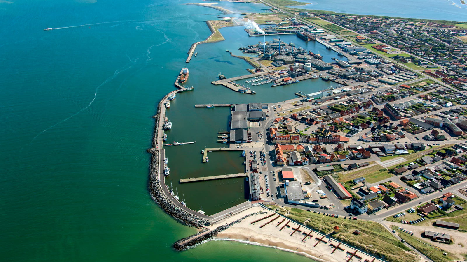
Thyborøn harbour is the country’s 5th largest and one of the area’s biggest workplaces. LE34 surveys breakwaters and technical installations and carries out volume calculations for raw-material extraction, where we use drones to record the piles of gravel and shingle on the quay before they are transported out for use on the country’s construction sites.
Agriculture and estates
Digital drainage maps, drone surveying and digital task management. We have adapted our advice so that we can create as much value as possible with a focus on the least possible impact on nature through our modern operations.

Solutions for the efficient farmer
Every day LE34 helps small and large farms become more efficient businesses through holistic advice, innovative drone surveys and smart digital tools. Our drones are used, among other things, to create an overview of your farm. In addition to contour lines, it is also possible to measure vegetation cover and heat radiation, which creates new opportunities for more efficient farming where resources are used better. We also use drones to record and document the maintenance condition of watercourses. For example, we can illustrate where a watercourse has trouble flowing freely, and pair the drone footage with facts about the watercourse’s shape and condition, giving a good overview. This makes the problem concrete for the municipalities and makes it easier for them to relate to problem areas where weed-cutting in particular must be taken into account.
Rural areas