Rural areas
Sectors
Green fields, watercourses and wind. Agriculture, boundary lines and wind farms. Our beautiful nature is both an asset and a resource, and we must protect it and optimise it when we tap into its power. We have therefore adapted our consultancy services to add the most possible value, focusing on ensuring the least possible strain on resources, which should preferably be renewable.
Insight and overview
LE34 collects, digitalises and analyses data when an agricultural holding is gearing for the future by purchasing or selling land or by planning and realising wind turbine projects. It is a matter of gaining an understanding and an overview of all relevant factors, handling authorities and understanding legislation. And we specialise in predicting and handling the problems that may arise.
Modern task management for modern farms and estates
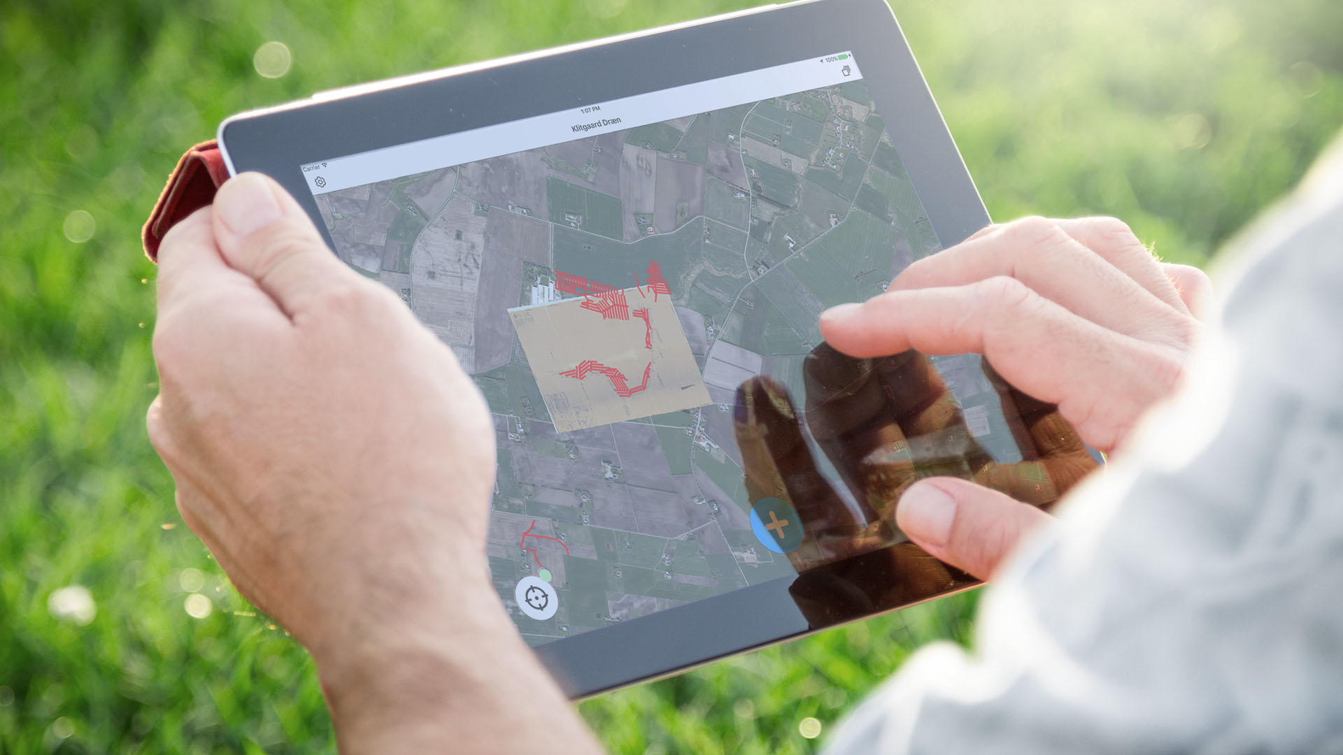
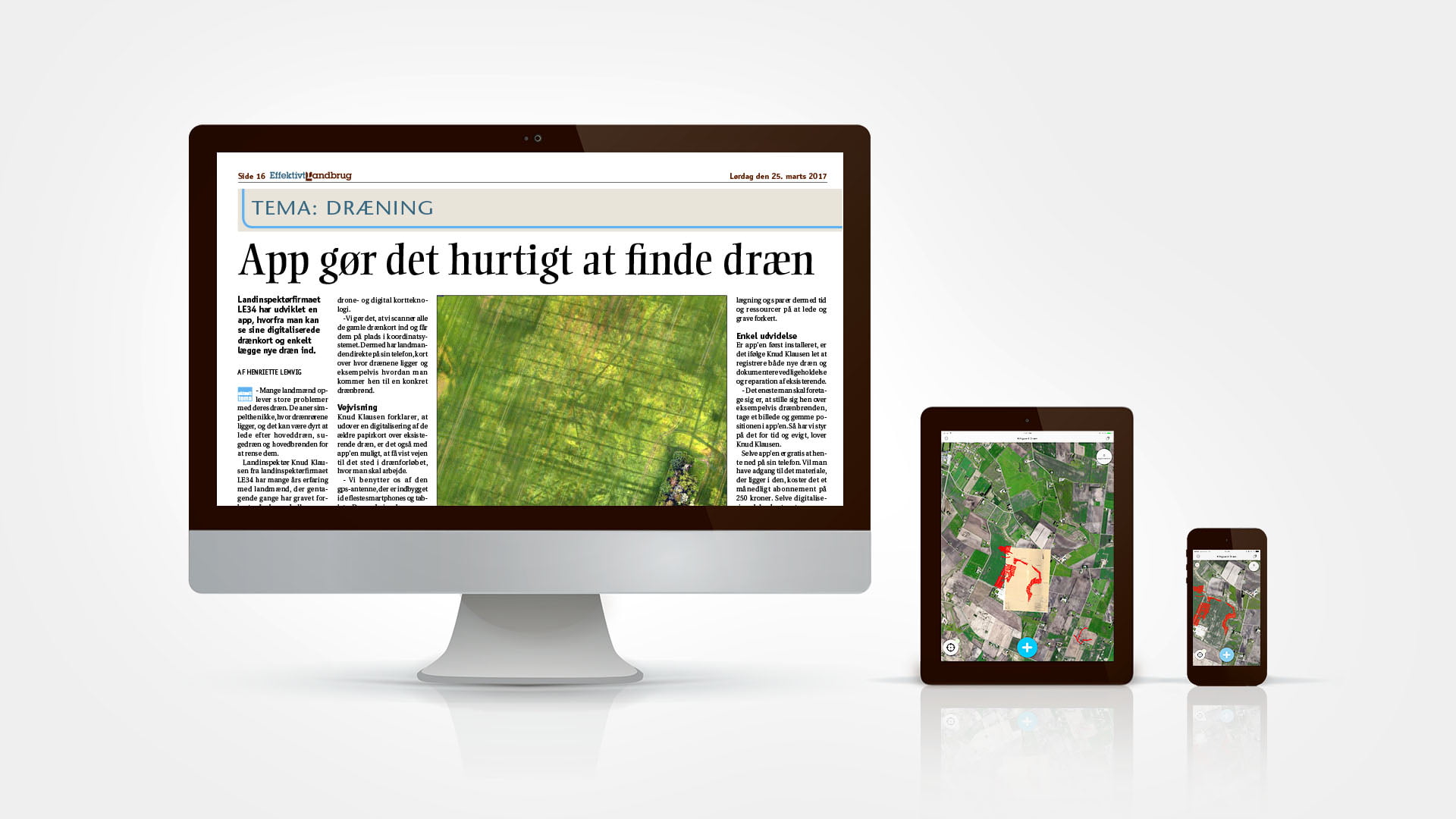
From old, incomplete maps to digital maps and summaries which can be accessed from the field, from behind the wheel of a tractor and from the office. LE34 has developed a mapping app that works on a computer, tablet or mobile phone. The app collects all drainage maps, information about boundary lines and watercourses and the day’s tasks in a single location where all of the farm’s employees can follow updates live and report changes and activities.
Michael Bundgaard, co-owner of Klitgaard Agro:
“We spend a lot of time every year on locating drains and wells. Up to now, we’ve mostly used guesswork to find and inspect the underground pipes but we’ve started adding the drain network to the digital system.”
UAVs give us the full picture
We combine overview with details when we collect data with our specially built unmanned aerial vehicles (UAVs). Our UAVs have cameras on board – reflex cameras, thermal cameras to identify heat leaks and NIR cameras to analyse crops – and we can provide complete photographic maps, 3D models or point clouds including all details.
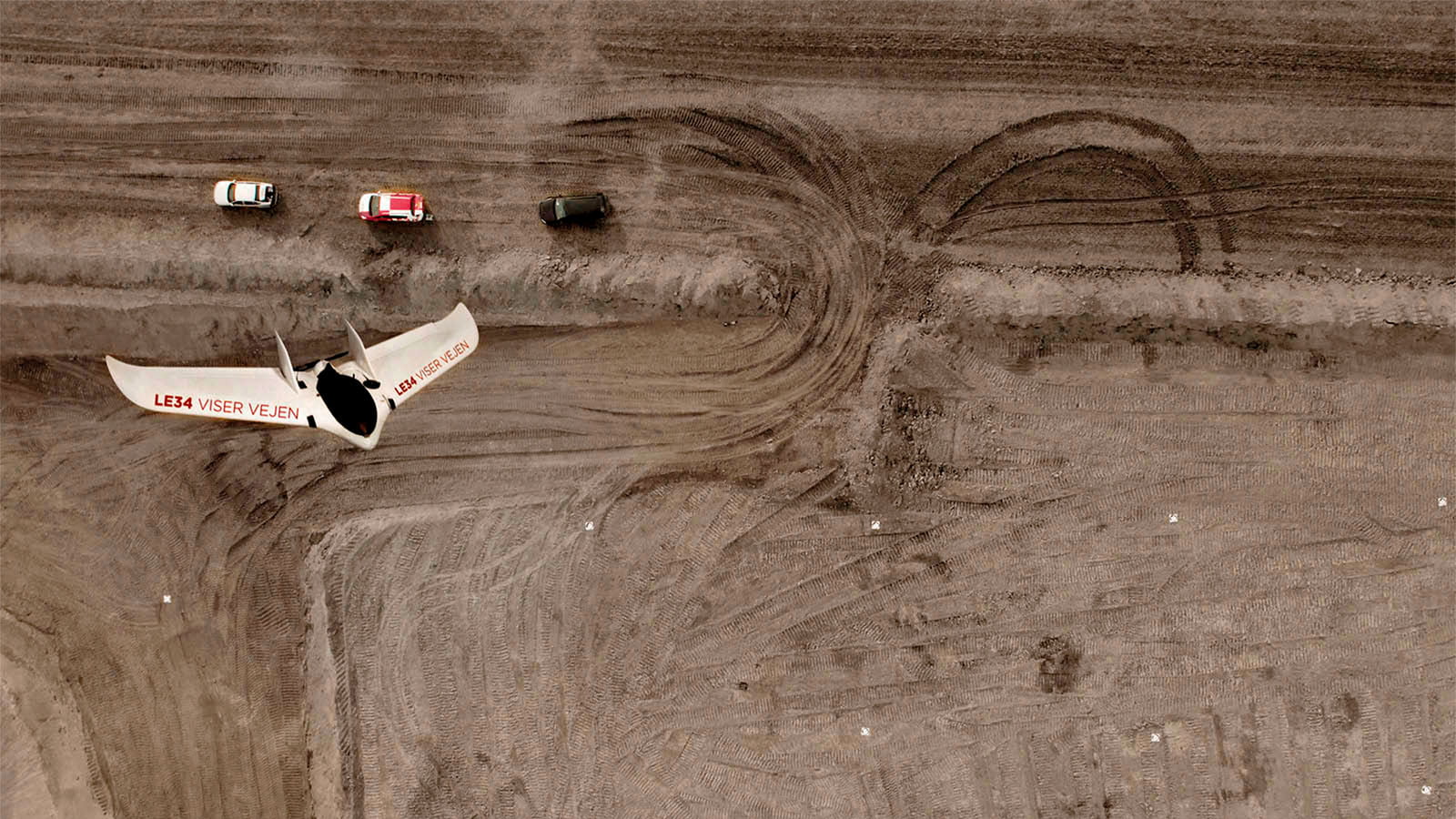
60 hectares surveyed in detail within the space of an hour
For large acreages, we use a so-called fixed-wing UAV. This looks a little like an ordinary plane, just scaled down. We have designed our own LE34 Scanwing, which can cover 60 hectares in an hour. With 25 UAVs nationwide, we are no more than an hour’s drive from any project – and this is essential, because our specially trained UAV operators need to be able to set off at short notice when weather conditions permit.
Knud Klausen, chartered land surveyor and partner, LE34 Dronninglund:
“We’ve noticed that there are lots of landowners who are interested in digitalising their old drainage maps. These were often drawn by hand decades ago and are full of corrections made each time drainage of a field was modified. Our digital tool, with geo-tagging of each drainage pipe, makes the handover of information to the next generation much easier.”
Find out more
CONTACT US
You are welcome to contact our specialists in agriculture and estates if you would like more information about our solutions.
Knud Klausen
Chartered land surveyor and partner
Expert in agriculture and estates
+45 9884 3567
kk@le34.dk


The connecting thread
Regardless of where you are located, LE34 is always close at hand.
Follow the thread. Explore the possibilities.


The connecting thread
Regardless of where you are located, LE34 is always close at hand.
Follow the thread. Explore the possibilities.