Digital cemetery maps
Projects
Goodbye to paper with its illegible notes, lines and arrows. And hello to razor-sharp digital cemetery maps that provide a clear overview and are easy to update. They save time and money – and bring substantial benefit to the daily lives of gravediggers, church wardens, the deanery and parish councils alike.
Client:
- Visborg Church
Period:
- 2019
Skills:
- 3D models
- UAV image maps
- Updated cemetery maps
- Ortho images
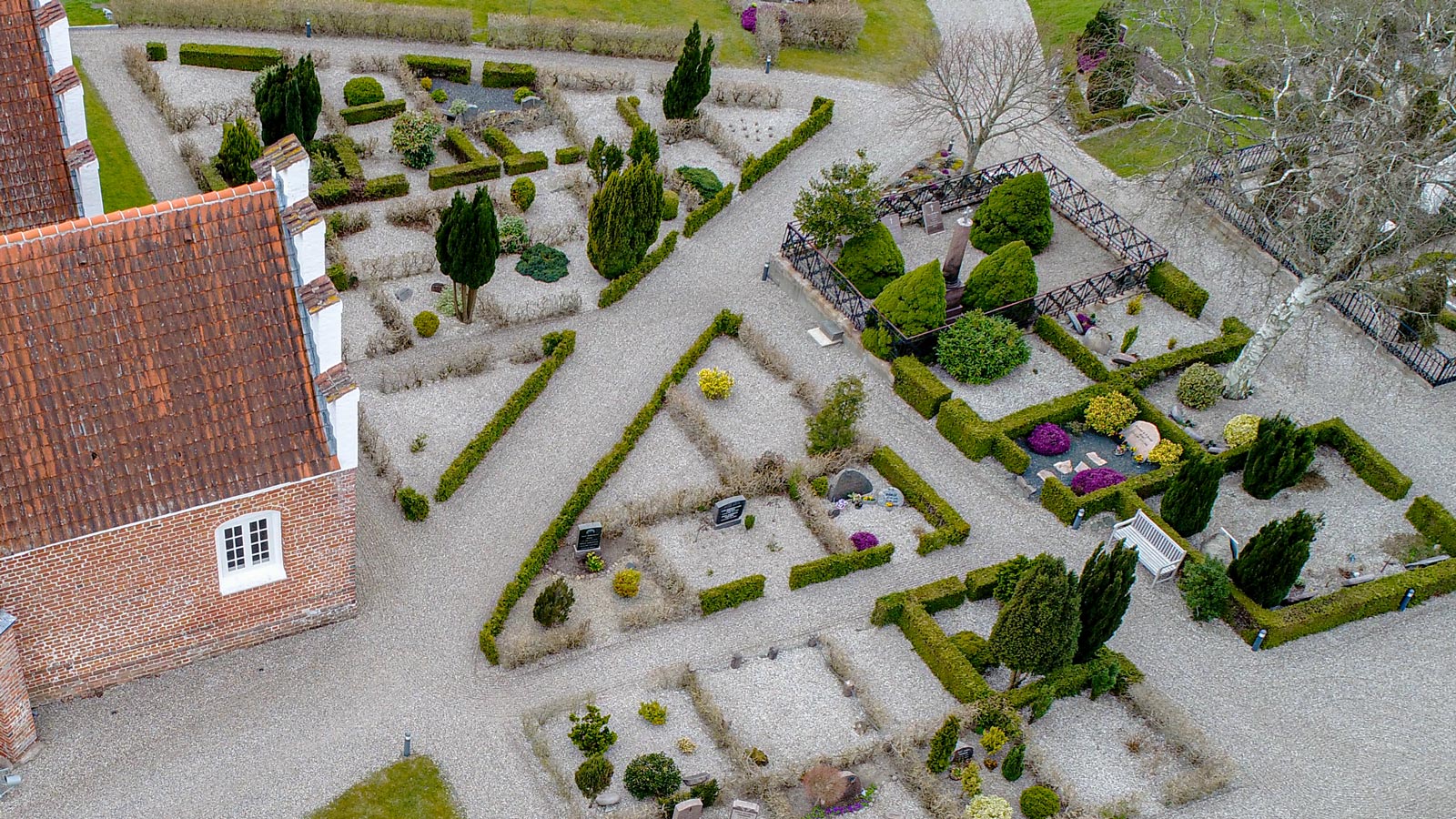
LE34 is helping modernise the maps of a large number of cemeteries in Danish parishes. We fly unmanned aerial vehicles (UAVs) over the cemetery and create a digital map that is so clear that the layout of the grave site can easily be seen when you zoom in from the cemetery office. UAV technology is efficient and means that even minor parishes, with small-scale cemeteries, can afford to reap the benefits of digitisation.
Digital maps give the necessary overview
Visborg Church was faced with the same challenges as so many other churches and parishes. The only cemetery map they had was a very old paper map, full of lines, crosses and colours that had been added by hand over the years. It was a confusing map, quite out of line with the reality of the cemetery.
With the help of a UAV, Visborg Church has now digitised its cemetery map.
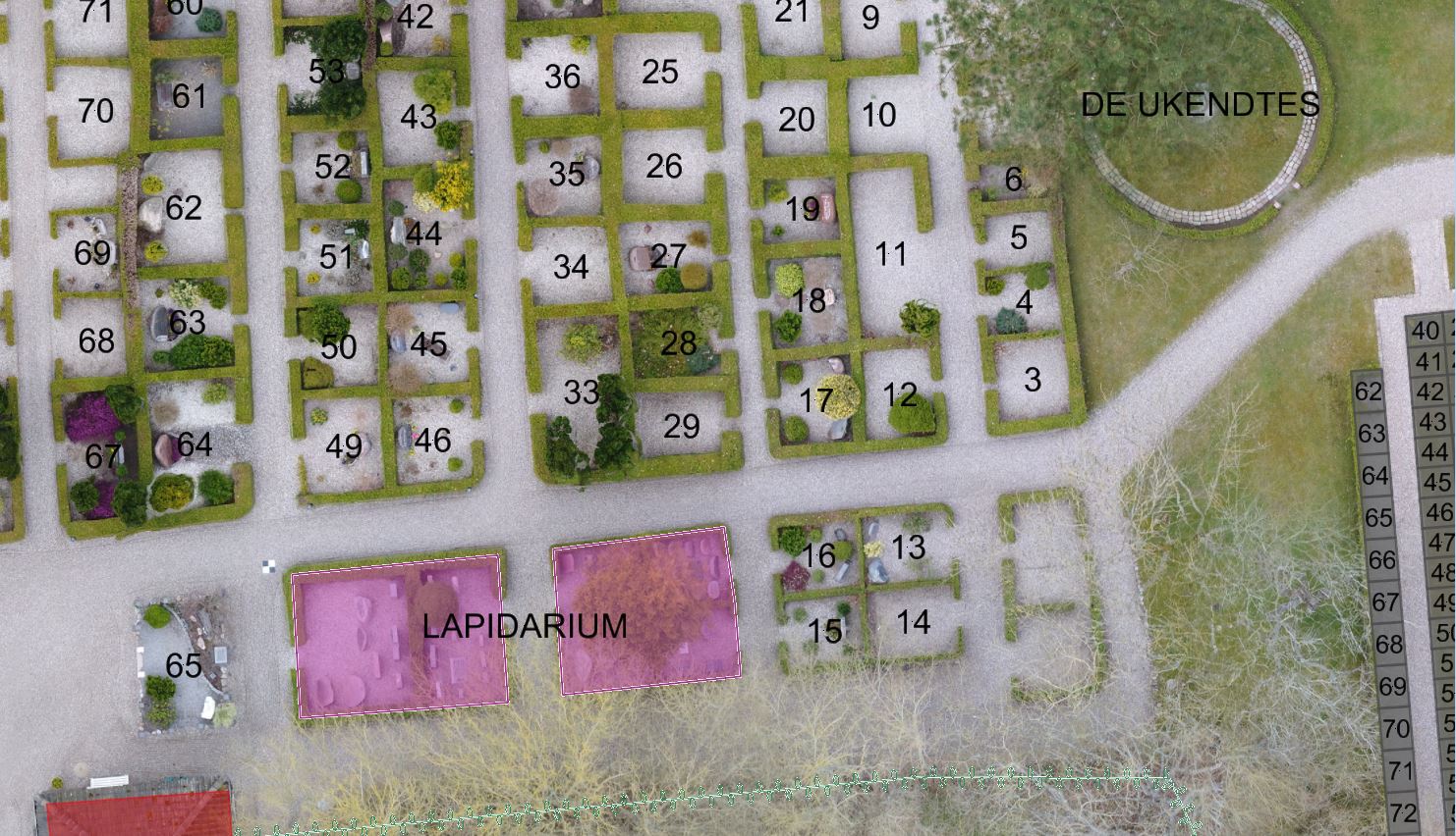
The new map is updated to show the existing conditions at the cemetery, and LE34’s experienced cartographer has cleaned up the colours and lines on the map. The result is an accurate map that provides a rapid overview.
Pernille Drøscher, church warden, Visborg Church
“My experience of LE34 was super. The process was excellent. They understood what we needed and didn’t try to oversell. They gave us a price for precisely what we required.”
Tailor-made solution
A digital cemetery map can make a long list of the cemetery’s everyday operation and maintenance tasks quicker and easier.
What’s more, LE34’s solution can be integrated into the software cemetery offices use for administration.
For example, in addition to the basic map function, you can use the map when a relative calls the office – just a few clicks, and you can zoom into the exact grave site and see updated information about the grave, such as for how long maintenance is paid up.
You can also use the map to plan the work of the gravedigger, measure how many metres of hedge to clip, schedule the clipping job, and plan major changes in detail.
The sky is the limit – your choices depend on the size of your cemetery and your needs.
Visborg Church uses the map for practical planning
Although Visborg Church is a small parish, with only a few hundred grave sites in its cemetery and one employee in the cemetery office to keep track of relatives belonging to each grave site, the new digital cemetery map is hugely important on a daily basis.
It is much easier to talk with others in the parish, in the deanery and on the parish council about changes to the cemetery when they have an updated map, free from lines and notes. For example, they might want to calculate how much fir is needed for winter grave blankets. In connection with an upcoming reorganisation of the cemetery due to the fact that there are fewer burials, they may need to discuss the best way to use and plant the surplus area. For this type of job, Visborg Church uses the digital map to evaluate the options.
Pernille Drøscher, church warden, Visborg Church
“The digital cemetery map makes it much easier for the parish council to decide on a change to the cemetery. Of course, we can go out and look at the cemetery, and it’s not as if we aren’t familiar with our cemeteries. But that’s a lengthier process. Now, all we need to do get together around a table and look at the same updated map without crossings out. The new map shows the cemetery as it is.”
Show the way for your visitors
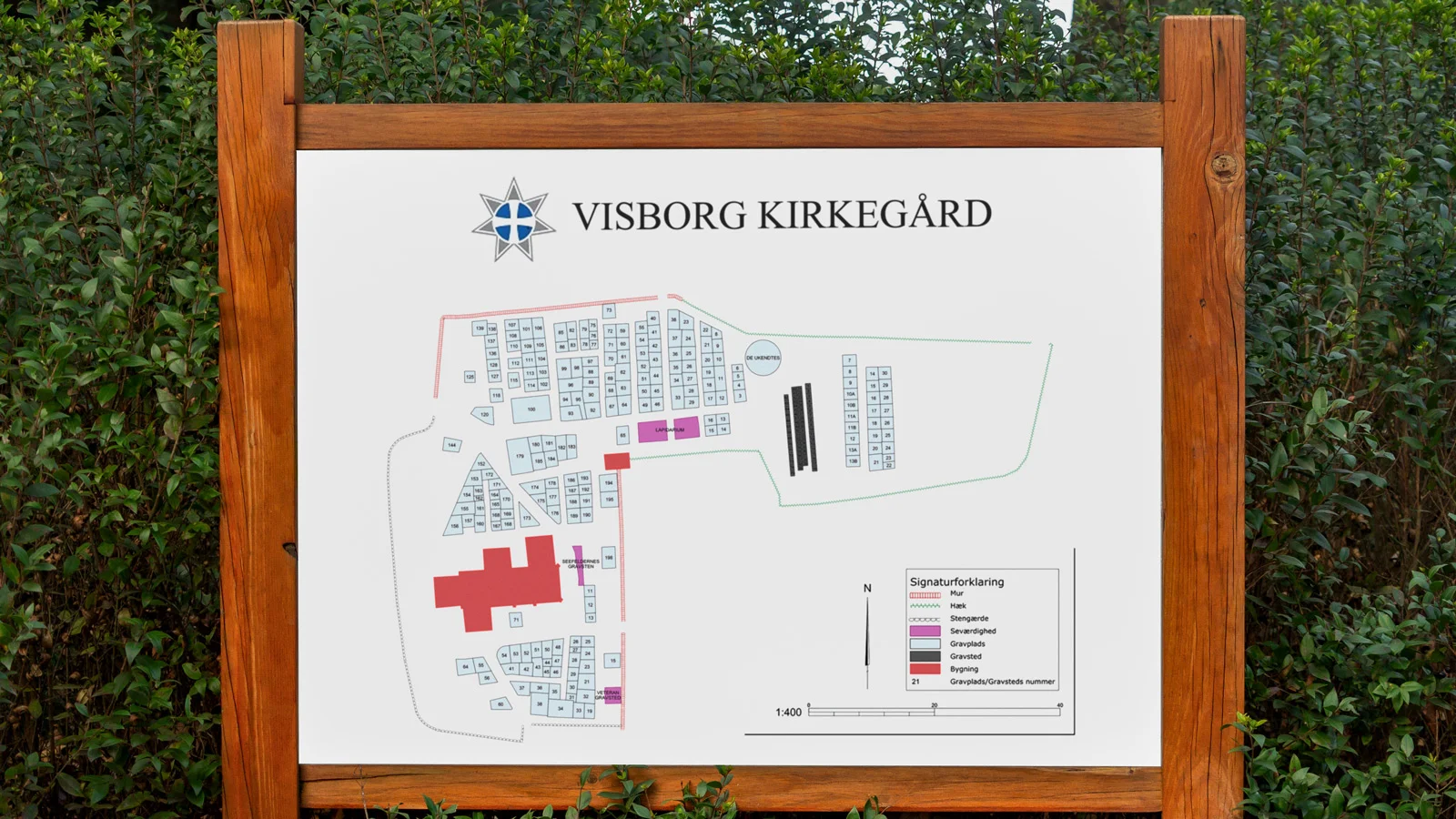
Once you have a proper map, your options are countless. For example, you can use it to give visitors to the cemetery a warm welcome. The new map is available from the information stands at Visborg Church, making it easier for visitors to find their way around.
Show the way for your visitors
Once you have a proper map, your options are countless. For example, you can use it to give visitors to the cemetery a warm welcome. The new map is available from the information stands at Visborg Church, making it easier for visitors to find their way around.
Contact the experts

Knud E. Klausen