Municipalities and regions
Sectors
We tailor our consultancy services and digital solutions to support the work of municipalities and regions: From expropriation of roads, paths and urban space to preparation of local development plans. From UAV mapping of new hospitals to digitalisation of existing buildings. And from handling enquiries from the public to planning assignments.


Tasks related to municipalities’ service provision are handled on time – even snow clearance
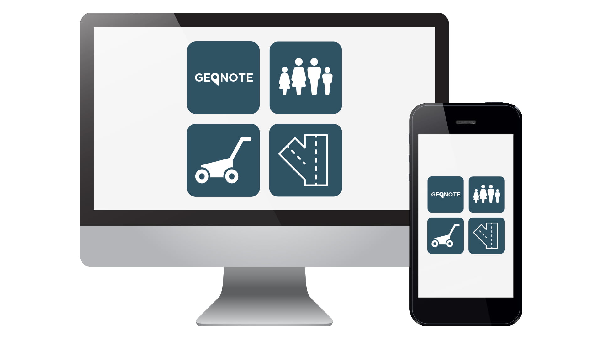
LE34 is constantly developing new tools to meet the needs of our clients. The digital world offers a wealth of opportunities, but solutions must be user-friendly – otherwise there is no reason to replace paper with digital tools. Our suite of intelligent digital tools, which we call GeoNote™, was developed in response to a specific daily need in the municipalities.
Planning and management of snow clearance, refuse collection, clear-up of overfilled bicycle parking areas, road inspection and much more: GeoNote™ is an intuitive tool, based on a digital map, and can be tailored to the specific needs of your municipality. Or to your region’s requirements for upkeep of outdoor spaces or management of indoor maintenance.
Whether you work for a municipality or for a region, there are great benefits to be had from using GeoNote™: It saves time and money; it ensures transfer of knowhow when experienced staff retire or change jobs; and it ensures that you are always able to provide documentation of the assignments that have been completed.
Intuitive and intelligent communication via Borgertip
Most municipalities have visionary communication strategies, but communication can easily become a time-waster for the staff responsible for answering the public’s questions – possibly many times during the course of a case. And some cases require coordination with other authorities.
LE34’s land surveying expertise and knowledge of digital maps can show the way here, too. Once a municipality has purchased the Borgertip app (for tips from and for the public), it is free for anyone living in the municipality’s area to use.
If someone sees a hole in a road, a broken waste bin, a street light that doesn’t work, or hogweed getting out of hand, they can report it. With just a few clicks, the Borgertip app registers the exact location of the hole in the road, a photo and a brief description. Staff at the town hall see the tip immediately and can respond and coordinate repair of the hole. The reporter of the incident can follow the progress of the municipality’s repair work.
If the tip is about a hole in a road for which the municipality is not responsible, or about hogweed in a natural reserve belonging to the Danish Nature Agency, the Borgertip app will also ensure that both the reporter and the agency are automatically informed.
‘Warnings’ to the public can be read at a click
The Borgertip app works both ways: tips from the public to municipality and tips from the municipality to the public, depending on the issue at hand. Municipalities can use it as a supplement to their websites and e-Boks to notify and ‘warn’ the public. This is extremely effective in acute situations, such as road blocks due to a leak in a district heating pipe or a flooded road.
Municipalities can also use Borgertip to inform the public about planned roadworks. Of course, municipalities already provide notifications and information of this kind but the clever thing about Borgertip is that it is intuitive, it is easy to use and it ensures that the notification is actually read.
The only thing members of the public need to do is install the Borgertip app and allow push notifications. All messages sent to Borgertip by the municipality will then pop up on the phone – easy to read and understand in their entirety, and immediately, at a click. No need to use a digital key card, or to log in, to read the rest of the message.
This means that the message will be read right away and not hours or days later when the notification is well out of date. And it makes people realise that having your finger on the municipal pulse makes sense.

Expropriation of roads, paths and urban space
LE34 has in-depth experience of the entire expropriation process associated with construction of new roads, paths and urban spaces – from initial advice to the municipality, with clarification of existing ownership and land requirements, to the final settlement of the expropriation.
Throughout the process, LE34’s chartered land surveyors maintain direct dialogue with the affected landowners, both at individual and at open public meetings. We are your guarantee that facts will be presented expertly and that the feelings landowners have for the property they are handing over will be handled professionally. We manage the local inspections and participate in distribution of land, focusing on issues such as restoration of wetlands. We set out both preliminary and final expropriation boundaries in the field.
LE34’s skills also come into play when a municipality wishes to enter into voluntary agreements with landowners. In such cases, we negotiate terms and compensation with the landowner on behalf of the municipality.
Local development plans and advice on spatial governance and urban development
How can a municipality develop an old industrial area close to a port into a new maritime metropolis? How can a municipality parcel out an empty field to create a new housing estate? How can the municipality ensure that there will be enough room for parking spaces in a new apartment district in the city centre? These are just a few examples of questions LE34’s chartered land surveyors are able to answer.
Due to the experience we have gained from countless projects, we are able to prepare a local development plan that meets both the municipality’s requirements and legislative commitments and easements. Our chartered land surveyors’ expert knowledge of planning legislation, area calculation, environmental legislation, legislation on open country and property development ensures that municipalities can realise their development plans.


The connecting thread
Regardless of where you are located, LE34 is always close at hand.
Follow the thread. Explore the possibilities.


The connecting thread
Regardless of where you are located, LE34 is always close at hand.
Follow the thread. Explore the possibilities.
Find out more

Contact us
Contact our specialist to learn more about how our GeoNote™ tools can streamline your planning, management and communication.
Peter Hagesø
Business consultant
LE34 Copenhagen
+45 7733 2246
peh@le34.dk