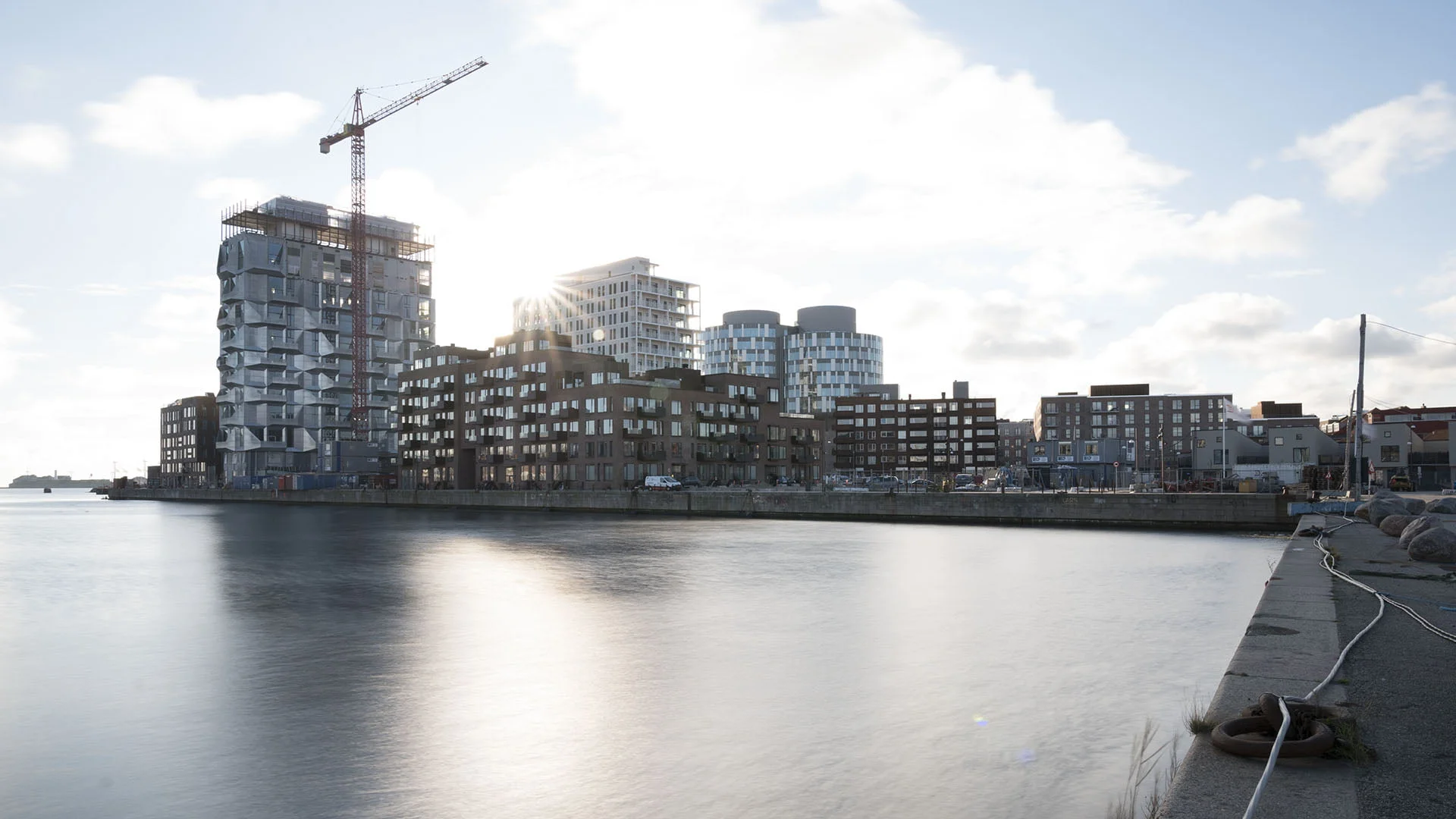
Harbours
Sectors
We provide accurate data for harbour facilities, both above and below water. Our nearshore and offshore experts expose hidden issues and provide a full picture, from harbour bed to bird’s eye view.
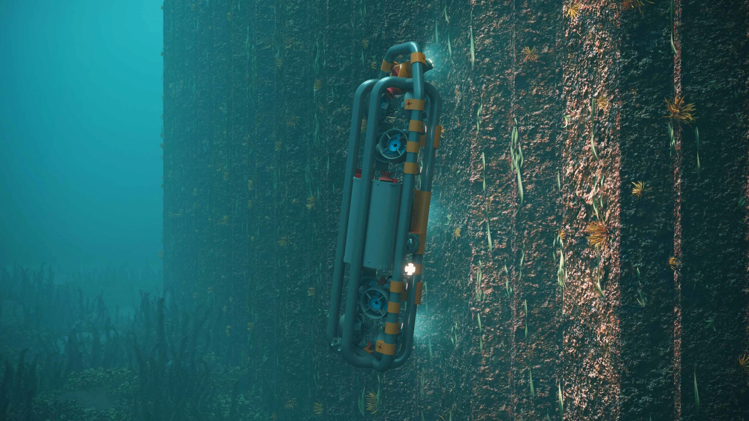
Underwater robot for high-precision surveying
In cooperation with some of the country's leading experts in robotics, LE34 offers high-precision measurements of underwater structures such as quay installations.
Underwater robot for high-precision surveying
In cooperation with some of the country's leading experts in robotics, LE34 offers high-precision measurements of underwater structures such as quay installations.
Modern methods save time
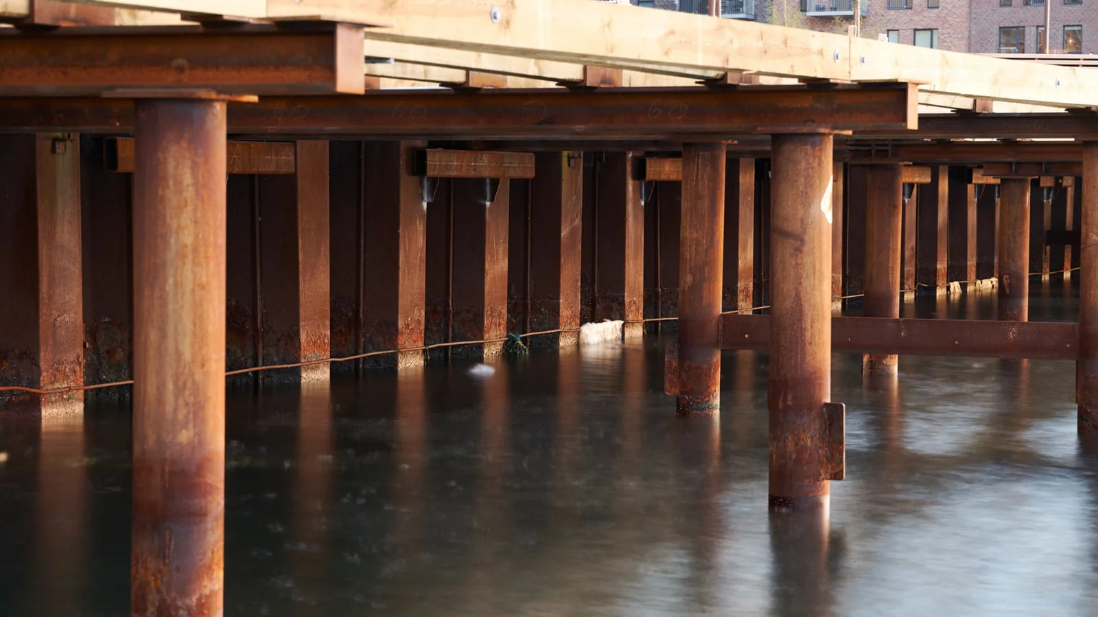
A large portion of a port facility lies under water. This makes inspections complicated and difficult to document. Traditional methods can be extremely time-consuming and do not always provide a full picture of the conditions. That is why we offer a solution to this challenge.
Underwater imaging gives us quick and effective insight into conditions on the harbour bed and enables us to detect deformations, damage or corrosion of installations that otherwise would remain undiscovered. Until now, divers have been needed for this type of inspection – a method that is both costly and time-consuming. Underwater imaging allows us to identify critical areas, which can subsequently be inspected more closely using detailed imaging.
High-resolution, high-precision underwater measurement and inspection
In cooperation with some of the country’s leading experts in robotics, LE34 offers high-precision surveys of underwater structures such as quay installations.
The newly developed Sentius system is built around an underwater robot (ROV) that independently navigates along the quay, the foundation or the object to be surveyed. The distance to the object is constant and is corrected automatically. This optimises the survey. It is not possible to achieve the same accuracy through manual control. In addition to the survey for a 3D model, photos are taken, allowing identification of even the smallest defects. Resolution and accuracy are of unprecedented quality.
Data presentation
All data can be displayed in PointView®, which our IT specialists have developed to provide fast, web-based access to both 3D data and photo documentation. We’ve also developed solutions for fast data access via smartphones and tablets, so port staff can easily access data without having to go back to the office. Of course, data can also be delivered to CAD systems so it can be used for design purposes.
Hydrographic surveys
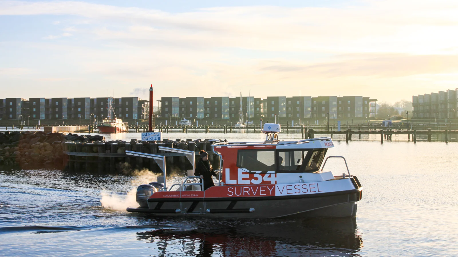
LE34 has carried out hydrographic surveys for over 20 years in some of Denmark’s largest ports, formerly under the name Nellemann Survey. Normally, the surveys are conducted from our own 17 foot surveying vessel, which can get around anywhere thanks to its size. The boat is transported on a trailer so we can reach the harbours quickly and at no cost.
The vessel has the latest sonar multi-beam surveying technology on board and is able to collect up to 25,000 points/second. A moon pool in the boat, which means all the surveying equipment is located at the centre of the boat, ensures optimal data quality. We use the approved EIVA and Navi-Suite software programs for data acquisition and processing.
In addition, we can carry out single-beam hydrographic surveys with a remote “Hydro-drone” or from a smaller, fixed-bottom inflatable dinghy. These are particularly suitable for surveying lake and harbour areas with relatively shallow water or difficult access conditions..
The LE34 also performs geophysical surveys with SideScan Sonar, Sub-bottom Profiles and Magnetometer and can take seabed samples.
One supplier
LE34 is the only company in Denmark that performs all types of surveys – both underwater and above water. Data is therefore prepared and structured so it can be used together, which is often crucial – for example in connection with the rebuilding and renovation of quay installations, where work is done both under and above water. We can also draw on our in-house experts in surveying and mapping wires, installations, buildings and bed areas.
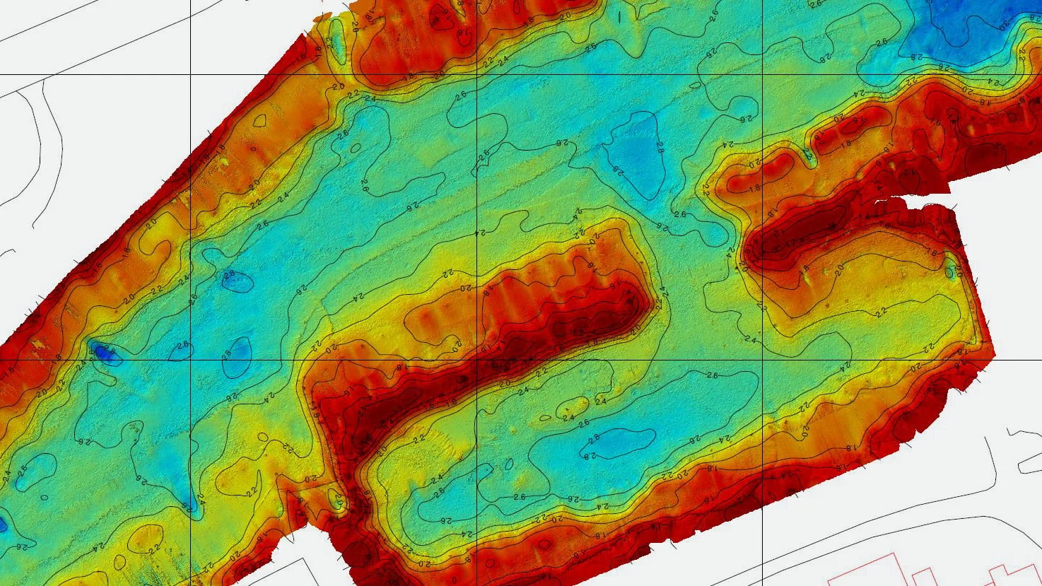
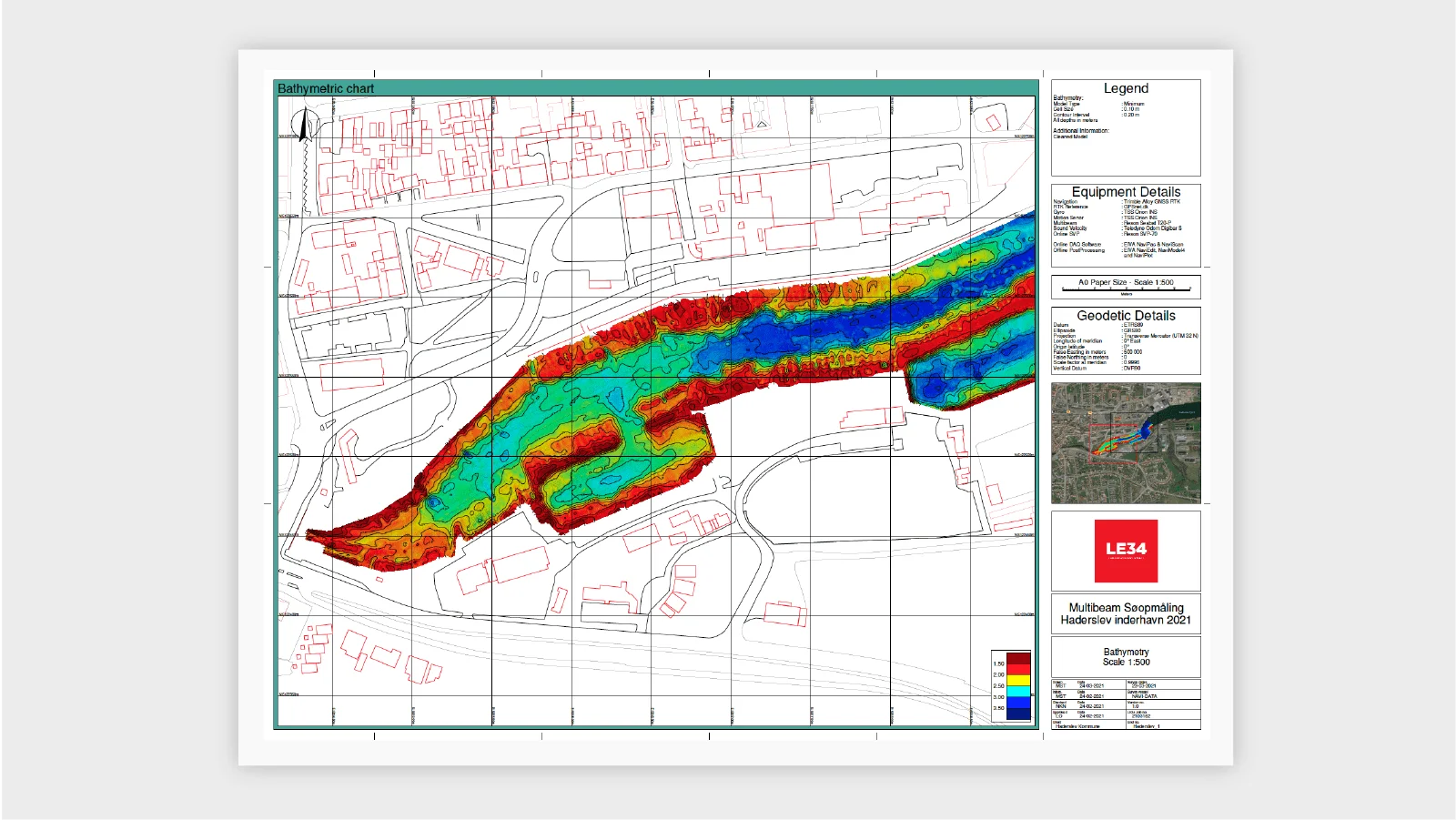
Depth control
Following the deepening of the harbour in Haderslev, grounding problems persist. LE34 has carried out an impartial survey which documents that the dredging carried out is insufficient. In several major ports, such as Aarhus, we regularly check the sailing depths so that dredging can be done in time to prevent grounding.
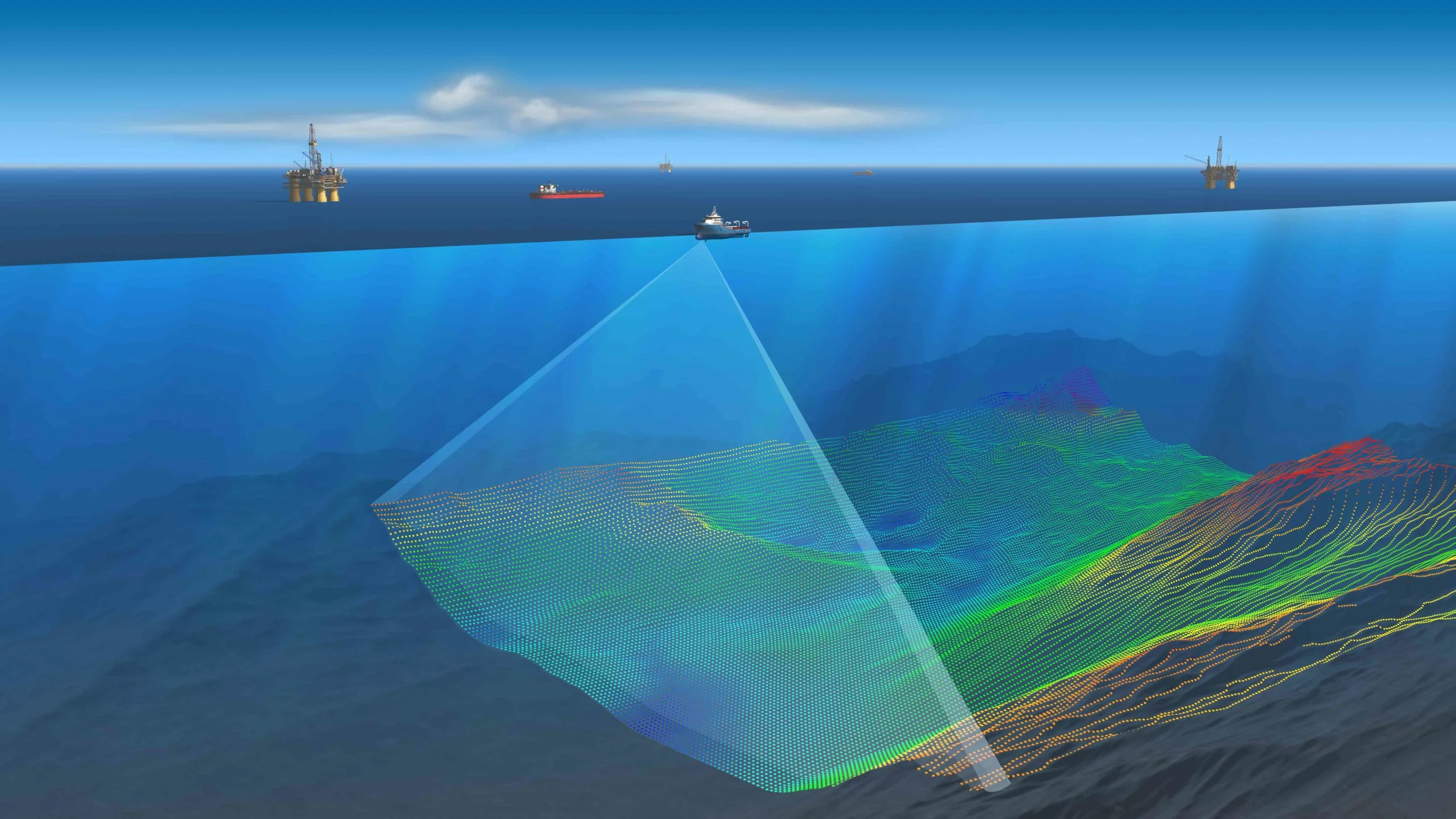
Underwater imaging and multi-beam
Our underwater imaging, combined with multi-beam hydrographic surveying, provides a complete overview of what is hiding beneath the water's surface.


The connecting thread
Regardless of where you are located, LE34 is always close at hand.
Follow the thread. Explore the possibilities.


The connecting thread
Regardless of where you are located, LE34 is always close at hand.
Follow the thread. Explore the possibilities.
Mikkel Præst Jørgensen, Chartered Land Surveyor, Mariagerfjord Municipality:
“LE34 surveyed our harbour facility from a UAV and generated an accurate 3D model of existing conditions. This model formed the basis for simulations of future rises in sea level, which we use for our climate adaptation projects. We’re very happy with the result.”
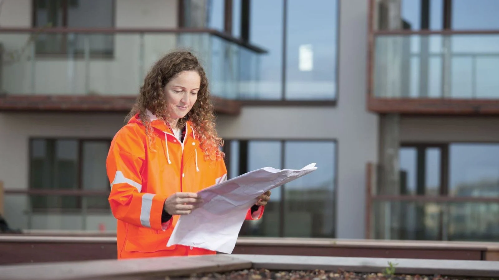
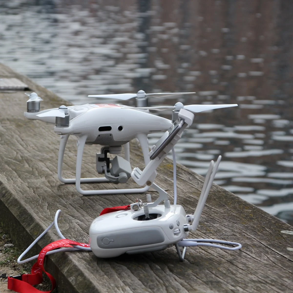
Effective harbour management with UAV surveying
Our custom-built unmanned aerial vehicles (UAVs) effectively collect data on harbour facilities, enabling us to supply detailed models of large areas on short notice. Planning of maintenance and repairs to wharves, bridges, breakwaters and buildings is improved by precise, digital 3D models, containing all of the information the municipality responsible requires.
By monitoring at fixed intervals, we can collect and monitor data on long-term movement of wharves, perform deformation surveys and identify changes before they cause a risk of collapse.
Learn more

Contact us
You are welcome to contact LE34 Offshore if you are interested in further details about our specialised skills.
Lars Overby
Chartered Land Surveyor / Head of Department, LE34 Offshore
+45 2275 5786
lo@le34.dk
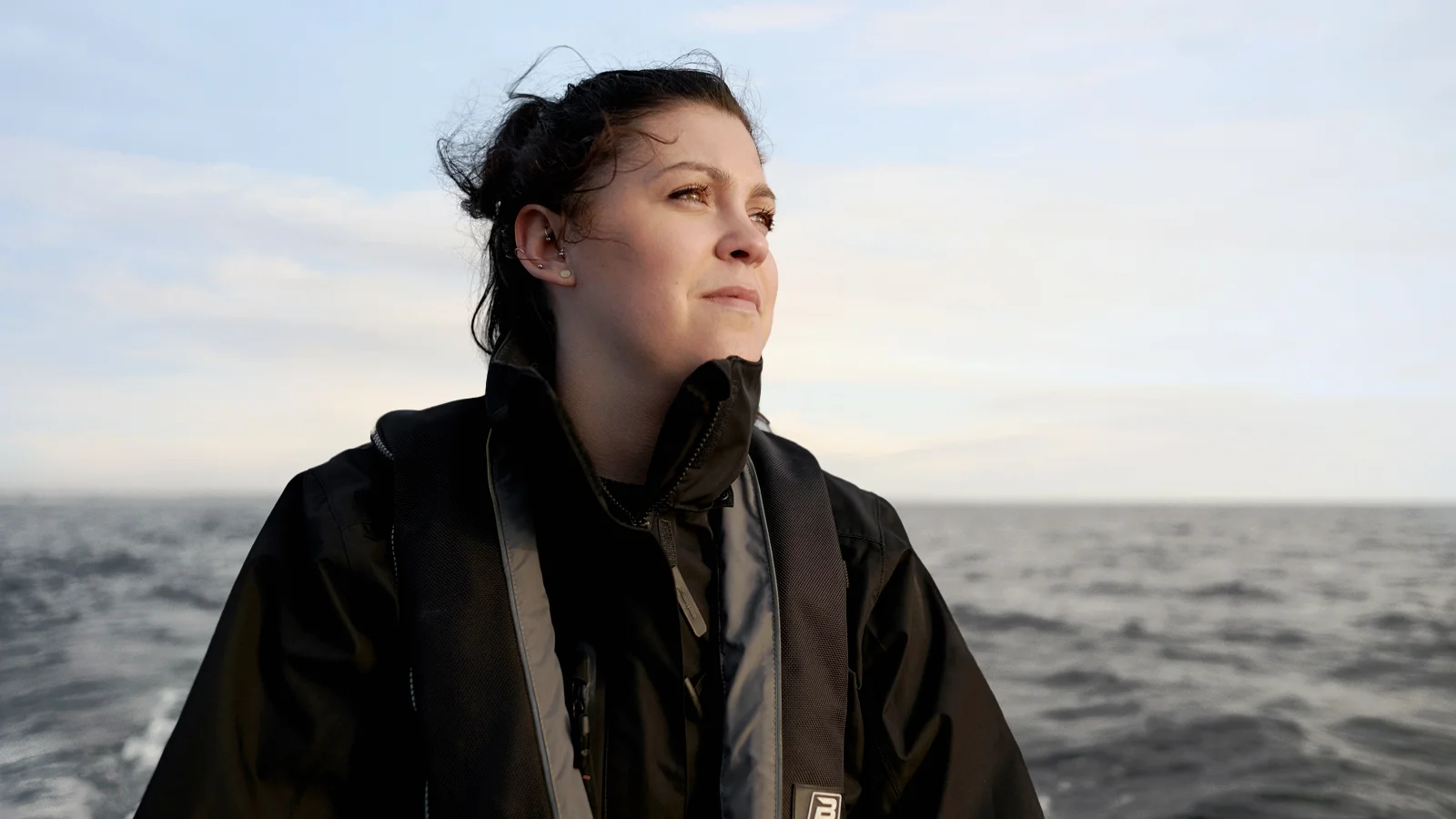
Lars Overby, Chartered Land Surveyor / Head of Department, LE34 Offshore
“Precise data on harbour facilities, both underwater and above water. Our nearshore and offshore experts expose hidden issues and provide a full picture, from harbour bed to bird’s eye view.”