LE34 Ringsted
Contact
LE34 Ringsted shows the way when it comes to future residential areas in the town and the entire surrounding area, to adaptation to climate change in the city centre and to highly specialised GIS solutions for a broad range of Denmark’s utilities companies.
Mellem Broerne 12, 4100 Ringsted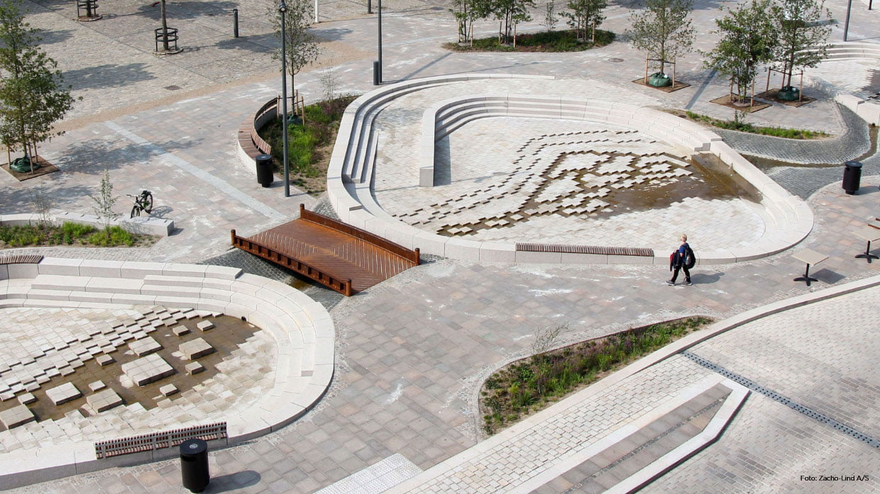
There, wherever you are
Our roots as a surveying consultancy in central Zealand go back as far as 1902. Today, we are the country’s largest provider of surveying and land management services.
Due to our size, you the client are always assured the best, most accurate and most user-friendly solutions, whether you require setting out for property boundaries for a private home, a site plan for the new, climate adapted market square or a new, digital system for utilities network management.
And we are there, wherever you are: from our office close to the railway in Ringsted, we can drive out to projects anywhere in western or central Zealand at a moment’s notice.
Local development plans and subdivisions lay the foundation for new projects
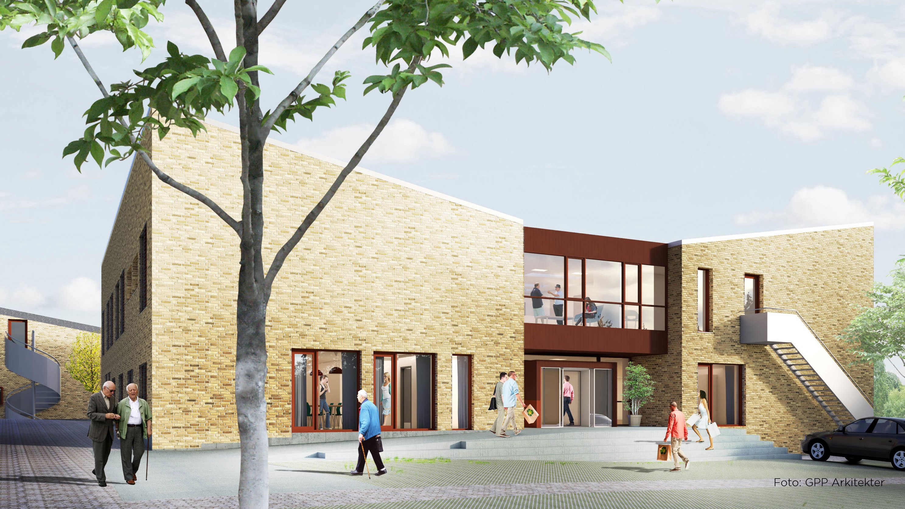
LE34 has been working in Ringsted for many years, drawing up local development plans and subdividing land for new districts. This includes, for example, the local development plan for the new health centre (designed by GPP Arkitekter, see the visualisation below) and subdivisions for Ringsted barracks, Nonnedalen and Kærup business park.

Local development plans and subdivisions lay the foundation for new projects
LE34 has been working in Ringsted for many years, drawing up local development plans and subdividing land for new districts. This includes, for example, the local development plan for the new health centre (designed by GPP Arkitekter, see the visualisation below) and subdivisions for Ringsted barracks, Nonnedalen and Kærup business park.
Land surveying shows the way to Ringsted Adventure Trail
What has a rosy-cheeked walk along the Ringsted Adventure Trail got to do with the world of LE34? Quite a lot, as it turns out: as a surveying consultancy, one of our core services is to provide advice on land tenure, land acquisition and land registration.
Based on advice and land registration by LE34, the Municipality of Ringsted has not only ensured that the city’s new adventure trail is open to the public, even though it crosses private properties, it has also ensured that it will remain a public footpath even if the properties change hands in the years to come. This means that you will continue to be able to enjoy a hike along the Ringsted Adventure Trail.
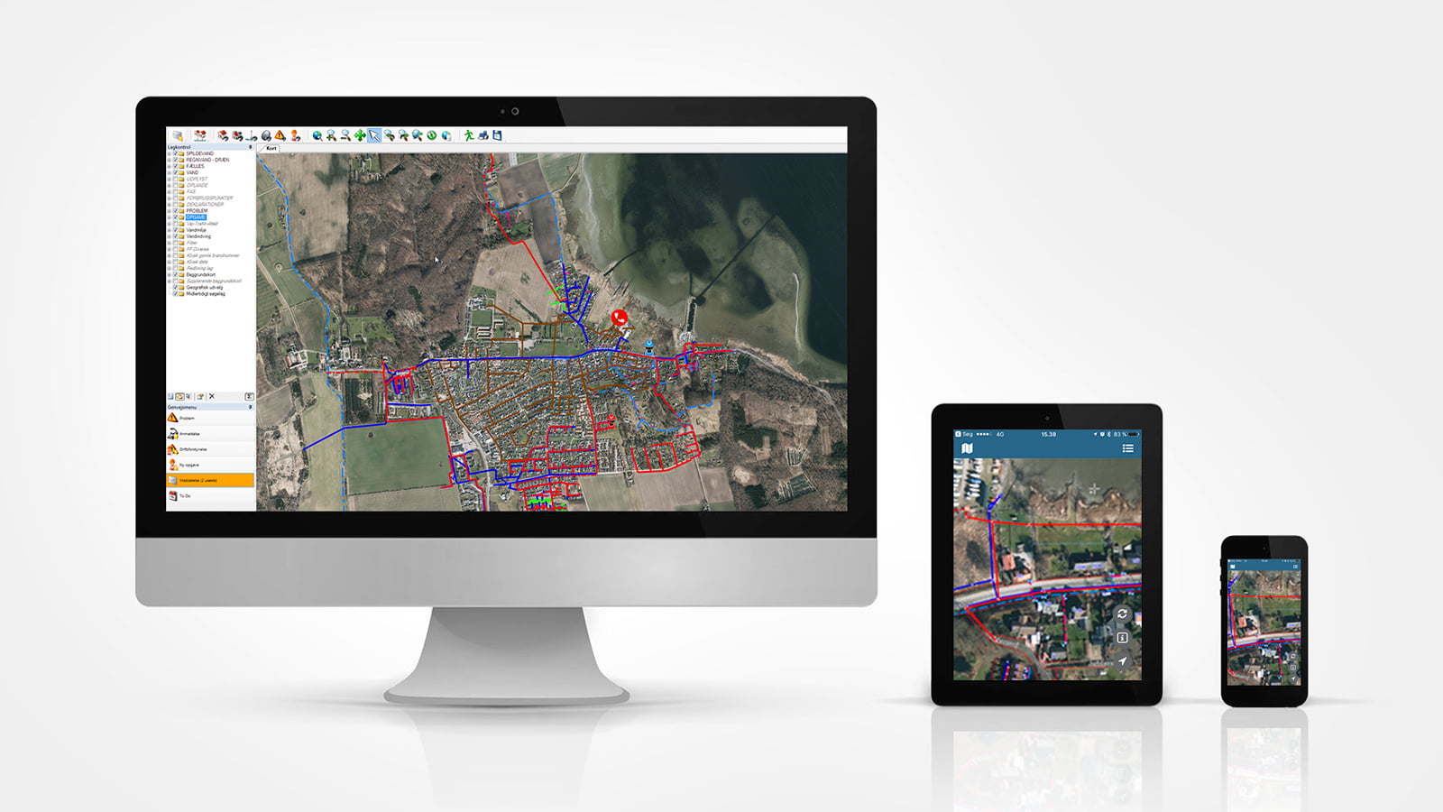
Ringsted – a hub for tomorrow’s utilities
We may not give it much thought when we turn on the tap and get clean water, or when the dirty, soapy water that drains from our washing machine disappears out of sight – that’s just the way it is. But, actually, there is a very large group of people behind ensuring that it all works. In addition to the utilities companies themselves, a wide variety of experts are also involved – among others, LE34.
As chartered land surveyors, we are uniquely skilled in handling geographically localised information and data, making us the country’s experts when it comes to developing the special tools needed by the employees of the utilities companies: digital tools, which ultimately have a huge influence on the service you perceive when you contact your utilities provider.
For example, we deliver the VA-banken utilities network management system and the GeoNote GIS system to Danish utilities companies such as Vejen Forsyning, Ringsted Forsyning, Faxe Forsyning and Kalundborg Forsyning.
We have staff with utilities expertise in several of our offices, but LE34 Ringsted is the accepted meeting point for our utilities and GIS experts. Thanks to the city’s central location, it is easy for all LE34 staff to meet up here.


The connecting thread
Regardless of where you are located, LE34 is always close at hand. Follow the thread. Explore the possibilities.


The connecting thread
Regardless of where you are located, LE34 is always close at hand. Follow the thread. Explore the possibilities.
Mogens Lykke Søndergaard, head of department and chartered land surveyor
‘No matter which service our clients request, I can help supply a robust solution. This is because LE34 has a nationwide presence, with a wide variety of experts in the field of land surveying. Although we’re a big company, we’re not afraid to make use of our colleagues, across locations and disciplines.’
Meet LE34 Ringsted

Daniel Jensen

Danni Rylander

Frederik Schjellerup Olsen

Karina Bay Rasmussen

Kim Verup

Mette Drachmann Høier

Mogens Lykke Søndergaard
Niels Madsen

Rasmus Rylander Hansen

Shiela Østergaard Christiansen