Mobile Mapping of cycle paths and roads for authorities
Projects
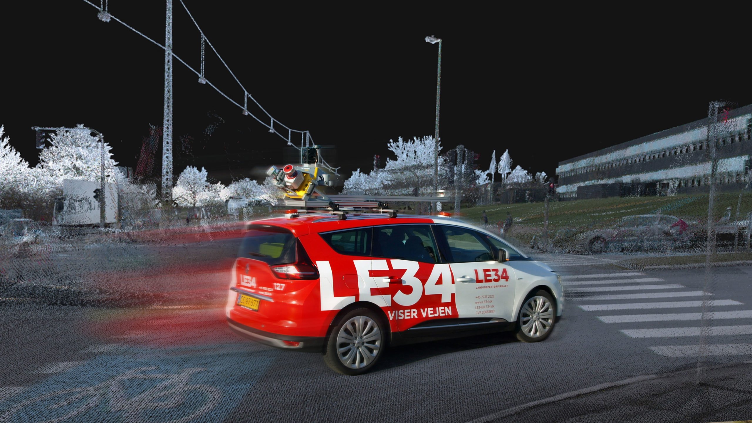
Municipalities and road authorities are already beginning to reap the benefits of our revolutionary Mobile Mapping technology and the associated PointView® web viewer. It has never been easier to perform surveying and design tasks, and the results have never been so detailed.

Around 20 road authorities in Denmark have already had parts of their road networks mapped using LE34’s Mobile Mapping. Two of these are the municipalities of Fredericia and Aalborg.
Municipality of Aalborg: design and analysis free from surprises
The Municipality of Aalborg wants to improve parking facilities on Fyensgade. At the same time, it needs to optimise the gradient of pavements and road surfaces, to reduce the volume of runoff water flowing into nearby basement wells. For these reasons, the municipality needed a survey of the existing conditions that was not merely detailed but accurate to the millimetre for x, y and elevations.
They ended up choosing LE34’s new Mobile Mapping technology, which collected huge volumes of data and 360-degree images of the road and surroundings in a very short space of time.
The result is a 3D model that sets completely new standards for the engineering design process. It enables the municipality’s road engineers to design the new parking facilities to the minutest detail because the model is accurate to the millimetre on all levels.
For example, the 3D model contains thorough details of the elevation and gradient, and this information is essential for managing drainage on Fyensgade. The municipality has designed a new demarcation plan for the area and carried out detailed design of a future cycle path, subsurface waste containers and new pavement surfacing to be included in the sewer project in 2022–2023.
Mads Rytter Asferg, engineer, Municipality of Aalborg
“An accurate survey was important so that we could carry out detailed design of future pavements, kerb clearance and a new cycle path in preparation for protection of the many basement wells against runoff water. Mobile Mapping gave us that.”
Fredericia Municipality: design of two cycle paths in no time
LE34 used Mobile Mapping in Fredericia Municipality to perform surveys of several kilometres of road network. As a result, the municipality now has fully updated images of the road section to support their design of new roads and installations. The system produces much more data than traditional land surveying methods.
For example, the 3D model generated by data from Mobile Mapping shows where there are stairways, basement windows, road markings and signs.
Apart from providing accurate, detailed data, the Mobile Mapping technology is an extremely efficient surveying method. LE34 can produce razor-sharp results even at 80 km/h. This means that a road section, which previously would have taken two employees 25 to 30 days to survey using traditional methods, can now be surveyed in a morning.
And this benefits our clients. It certainly speeded up the design process at Fredericia Municipality – two cycle paths were designed in only a few weeks.
Morten Kurtzman Svanborg, head of Roads and Parks, Municipality of Fredericia
“The roads were surveyed using Mobile Mapping on the Tuesday, we put the files into PointView®, and the consulting engineer started designing on the Monday. All in all, we surveyed and designed two cycle path projects in three and a half weeks and then began construction work. We could never have done that using traditional land surveying methods.”
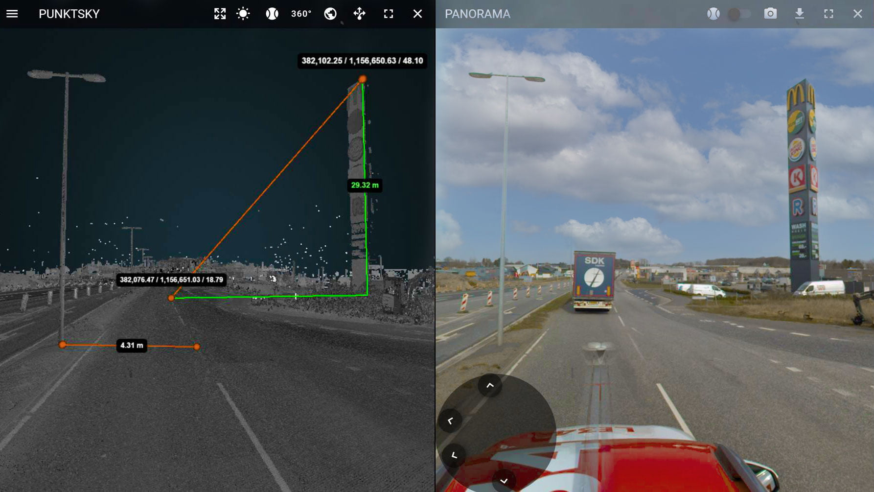
PointView® makes it easy to use survey data
The huge volumes of data we collect using Mobile Mapping can cause a standard computer to crash. For this reason, we developed the PointView® web viewer which enables our clients to access data via their browser. Staff at the municipalities of Fredericia and Aalborg can perform surveying, registration and design activities easily and intuitively without needing to be a 3D specialist or to use special programs.
They can go into PointView® at any time during the design phase and take a measurement or check a detail – no need to leave the office or order a new survey because measurement of a pavement elevation was initially omitted. With Mobile Mapping, everything is surveyed in one fell swoop and is readily available throughout the work process – both to the municipality’s own employees and to any affiliated consultants.
Mobile Mapping covers many kilometres of road. Therefore, the data received by the municipalities of Aalborg and Fredericia can be used for much more than their current, specific construction projects. They will also be applicable to other, future projects in the same area because they are already available in PointView®, and there will be no need to order a basis for design and analysis.
Construction work rests on a detailed foundation
The high degree of accuracy and the many details in the 3D model in PointView® make it possible to design new pavements, cycle paths, roads and parking spaces to the minutest detail. This minimises the risk of error and the need for adjustments during construction work.
Mads Rytter Asferg, engineer, Municipality of Aalborg
‘Due to the data collected in the form of images and a point cloud in PointView® our need for inspections and to conduct our own surveys in the field is substantially reduced.’
Find out more
Contact us
You are welcome to contact project manager Anders Møller if you are interested in further details.
Anders Nygaard Møller
Partner / Chartered Land Surveyor
Director, LE34 Engineering Surveying
+45 5131 4212
am@le34.dk