Baltic Pipe®
Projects
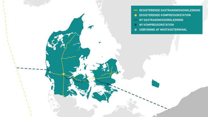
‘Hot lines’ between Norway, Denmark and Poland:
The new Baltic Pipe gas pipeline between the three countries gives us heat in our radiators and a new gas infrastructure with substantially increased capacity. As a provider of surveying and land management services, LE34 is responsible for quality assurance of the digital cadastral map on which the forthcoming expropriations for Baltic Pipe will be based.
Customer:
- Energinet
Period:
- 2019
Skills:
- Cadastral map adjustment
- Assessment of cadastral map quality
- Adverse possession analysis
- Easement analyses
- Expropriation consultancy
- Assessment of easement impact
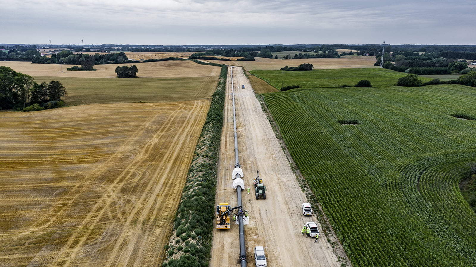
Baltic Pipe® runs from the Norwegian gasfields in the North Sea to Poland and consists of both offshore pipelines and pipelines that will need to be laid onshore – and a total of 210 km of new gas pipelines will be laid across Denmark.
Quality assured cadastral maps for the forthcoming expropriations
The construction project will affect the properties of a great many people, and the land for the new gas pipeline will be acquired by expropriation. Energinet is responsible for the construction of Baltic Pipe in Denmark, and they have chosen LE34 to conduct an extensive adjustment of the cadastral map.
As a provider of surveying and land management services, we have specialist skills in alignment and adjustment of the digital cadastral map as well as extensive experience in easement analyses, gained from numerous utilities projects.
Team of specialists in cadastral map adjustment
We have assembled a team to handle this project, consisting of technical assistants, chartered land surveyors and a legal expert. The project will apply a combination of automated GIS processes and manual reviews whereby we examine the existing digital cadastral map, measurement data and ortho images to identify any discrepancies between the cadastral map and the actual conditions. In the course of the process, we also perform an easement analysis and assess whether there are any easements which may have an impact on the forthcoming expropriation.
Our work results in a quality assured cadastral map, aligned for use by Energinet in expropriation documents and to ensure, to the extent possible, that the expropriation process is based on an accurate cadastral map.